
| glossary | menu | Normal | lg | hc | 9.) Fluvial Geomorphological Applications in River Forecasting > Karst Influence - Santa Fe River of SERFC |
| < Previous | 1 | 2 | 3 | 4 | 5 | 6 | 7 | 8 | 9 | 10 | 11 | 12 | 13 | 14 | 15 | Next > |
Karst Influence - Santa Fe River of SERFC

This live Internet image shows the region surrounding the Santa Fe River in Florida. The SERFC is responsible for operational forecasting in this region. This map does not show the subterranean dissolved limestone (calcium carbonate enriched rock) geological structure beneath the surface. Later maps shown in this FGM Module Section do show geomorphologic connections between this karst geology and the surface by sinkholes. Interesting for operational forecasting, many of the sinkholes intersect with the Santa Fe River.
To find the area of the Santa Fe (USGS Gauge 02322500), locate Fort White on the image. Karst topography is underlain with caves and underground channels that siphon surface runoff and reduce the expected Bankfull, or channel forming, flow per watershed drainage area. As such, a watershed in karst terrain will often experience flooding at lower discharges than non-karst watersheds of a similar drainage area.
Please note, if the picture is absent, there may be a problem with the remote server, and you can click on this smaller image to see an archived picture of the site. 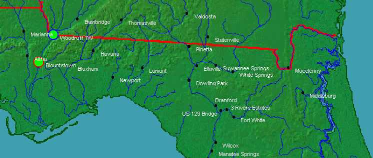 Image courtesy of NOAA
| < Previous | 1 | 2 | 3 | 4 | 5 | 6 | 7 | 8 | 9 | 10 | 11 | 12 | 13 | 14 | 15 | Next > |