
| glossary | menu | Normal | lg | hc | 9.) Fluvial Geomorphological Applications in River Forecasting > Underground Rivers of Karst |
| < Previous | 1 | 2 | 3 | 4 | 5 | 6 | 7 | 8 | 9 | 10 | 11 | 12 | 13 | 14 | 15 | Next > |
Underground Rivers of Karst
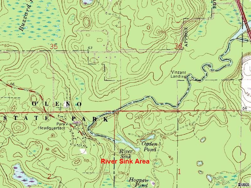
The Santa Fe River exhibits some of the processes previously discussed, such as shifting flow regimes due to watershed losses of surface runoff. In this topographic map of the River Sink, there are more than 20 sinkholes. In fact, in Oleno Park, FL for one 5 km section, beginning at River Sink shown in red text in this image, the River goes completely underground. The land above is referred to as the natural bridge. Such a disappearance places a new interpretation to base level lowering, incision, and decreased entrenchment ratio.
A Rosgen Level I or II classification of the Santa Fe River at this area has not been made available for the FGM Module, but the adjoining image provides an opportunity to estimate various morphological patterns, such as Meanders and Valley slopes. Further, Rosgen Level III stability indicators such as river size and flow regime influences can be inferred from the maps and written description of the Santa Fe River system.
Image courtesy of USGS
| < Previous | 1 | 2 | 3 | 4 | 5 | 6 | 7 | 8 | 9 | 10 | 11 | 12 | 13 | 14 | 15 | Next > |