
| glossary | menu | Normal | lg | hc | 5.) Rosgen Classification of Valley & General Stream Type > Characterizing Valley Types |
| < Previous | 1 | 2 | 3 | 4 | 5 | 6 | 7 | 8 | 9 | 10 | 11 | 12 | 13 | 14 | 15 | 16 | 17 | 18 | 19 | 20 | 21 | 22 | 23 | 24 | 25 | 26 | 27 | 28 | 29 | 30 | 31 | 32 | 33 | 34 | 35 | 36 | 37 | 38 | 39 | Next > |
Characterizing Valley Types
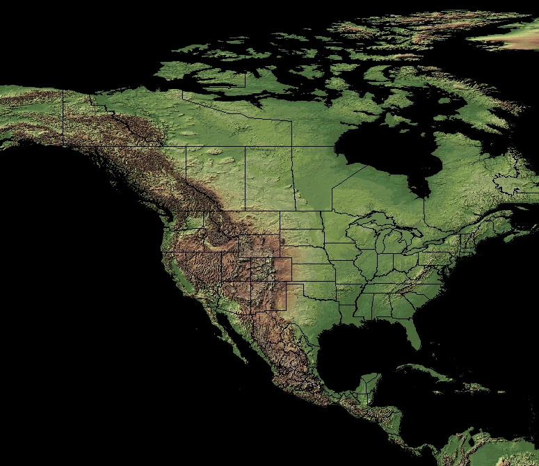
Basin relief, land forms, and Valley morphology are assessed from maps and imagery to inform the Level 1 classification. In this upper image, terrain relief imagery is provided for North and Central America, and part Greenland and South America. At this small image scale, few details can be extracted about Valley morphology. General Landforms, however, are apparent, with broad mountainous regions bordering the western continental areas, narrow and lower Elevation mountains lining portions of the eastern coastline, and expansive plains throughout the interior. The lower image reveals how the river networks respond to these coarse basin relief analysis along the western US, with dendritic networks in the broad Valleys, and radial patterns eminating from the mountains.
Several Valley types are described in the Rosgen classification system. Eleven Valley types are introduced in the subsequent slides of this FGM Module Section. The exercises at the end of this Section will provide an opportunity to examine topographic maps and photographs and classify Valley types. These Valley types are often used to make inferences on associated Stream types. The following slides will identify key features of 11 Valley types.
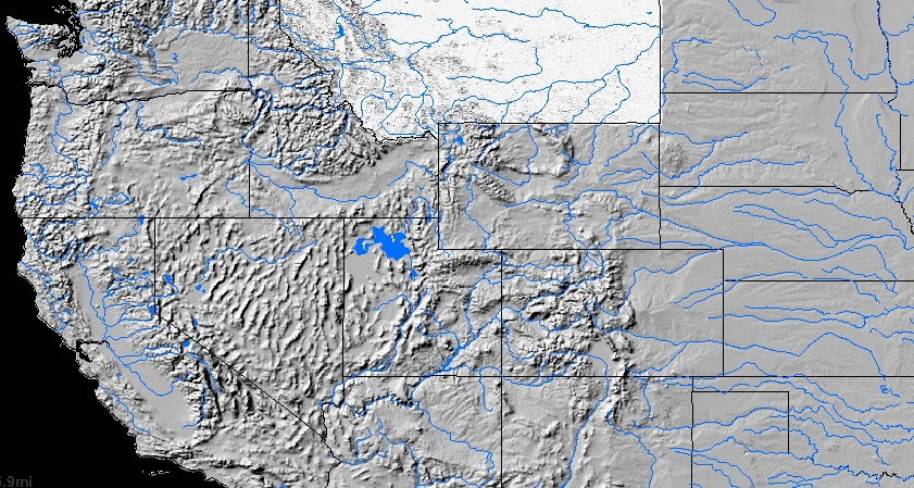
Image courtesy of USGS
| < Previous | 1 | 2 | 3 | 4 | 5 | 6 | 7 | 8 | 9 | 10 | 11 | 12 | 13 | 14 | 15 | 16 | 17 | 18 | 19 | 20 | 21 | 22 | 23 | 24 | 25 | 26 | 27 | 28 | 29 | 30 | 31 | 32 | 33 | 34 | 35 | 36 | 37 | 38 | 39 | Next > |